
How mapmakers viewed Ridgefield
with notes by Jack Sanders
 Indians
of Ridgefield in 1665
Indians
of Ridgefield in 1665
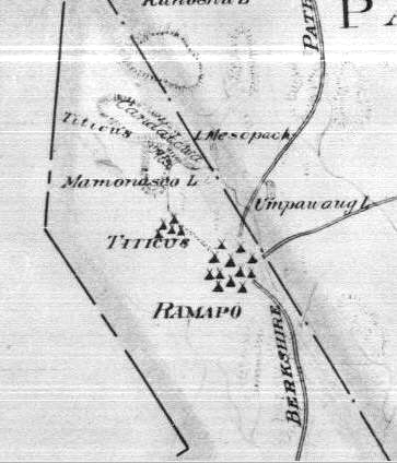
Hayden L. Griswold drew this map in 1930 to represent the
American Indian encampments or villages, plus Indian
trails, in Connecticut in 1665. The map was made for the
Connecticut Society of the Colonial Dames of America, for
a brief history of the Indians of Connecticut. Like many
others below, this is a small section of a map of the
whole state. The map shows the "Berkshire Path," an
old Indian highway that ran from Norwalk north to
Massachusetts. Much of Route 7 is probably based on this
path, but notice that instead of going through the Sugar
Hollow as Route 7 now does north of Ridgefield, the Indian
path veered northeasterly on Simpaug Turnpike and went
into Redding on up through Bethel to Danbury.
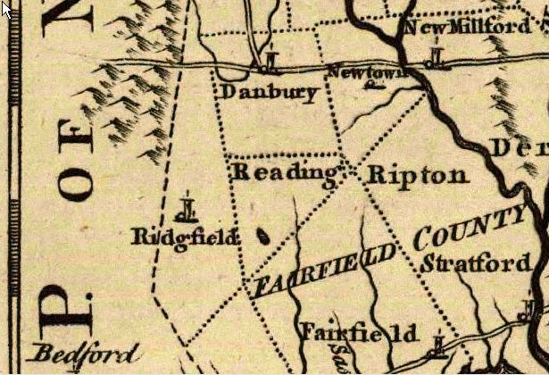
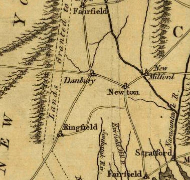
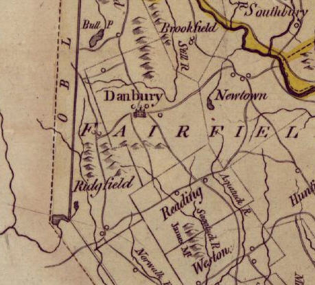
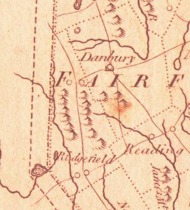
Kitchin's map of 1758
This portion of "A Map of the Colonies of Connecticut and
Rhode Island" was drawn by Thomas Kitchin and published in
1758. The boundaries of the towns are not precise, but
this does show how Ridgefield extended through what is now
western Danbury. The symbol that looks like a candle in a
holder, but is actually a church or town house, represents
where the town center was. Note that Redding, originally
spelled Reading after early settler John Read, has none.
That is because at the time the map was made, Redding was
a parish of Fairfield, to the south. Notice, too,
that this map and several below spell Ridgefield as
"Ridgfield," which was an early version of the name.
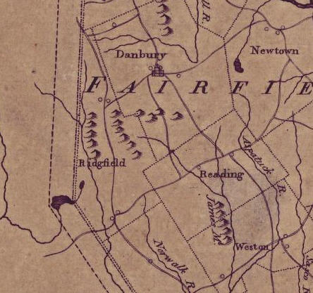
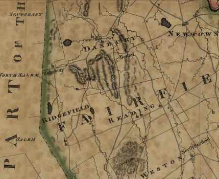
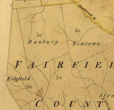 Park's
map of 1766
Park's
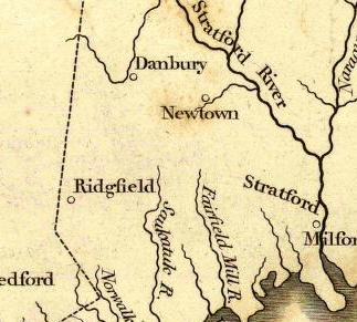
map of 1766Moses Park's map of Connecticut, published in 1766, adds little information. It shows only major streams running through the town. The old spelling of the town's name is used. Redding parish is not even named, though the church building signifies that the area was at least a parish within Fairfield.
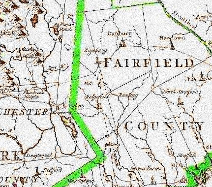 Romans
map of 1777
Romans
map of 1777
Bernard Romans drew a map of Connecticut in 1777 that
shows some of the major highways. In Ridgefield, it
depicts inaccurately the route between Ridgebury and the
center of Ridgefield village. The map also shows a road
from Ridgebury center, running out of town southwesterly.
This was probably Spring Valley and Mopus Bridge Roads.
All these roads are shown almost identically on the Covens
map below, suggesting Covens may have copied this map.
This map and others also show the old Oblong, the land
ceded to New York in 1731, just to the west of the
Connecticut line. It shows the territory that was part of
Ridgefield before 1731. Note that Ridgefield is spelled
"correctly" for the first time on a map, but that
Ridgebury is spelled Rigebury.
Hinton map of 1780
The author is unknown, but this map of Connecticut was published by J. Hinton in London in 1780. Ridgefielders may feel insulted by the gross misspelling of the town's name. Major roads are loosely drawn. Also odd about this map is the depiction of what seem to be huge mountains to the west of Ridgefield, yet none within Ridgefield where, in fact, the hills are higher. Even more incredible is the map's placement of New Milford in Southbury.
Covens map of 1780
This 1780 map of the state, published in Amsterdam,
Holland, is attributed to "Covens et Mortier et Covens
Jr." Roads are inaccurately shown. The road from the
center of Ridgefield north to Ridgebury is most likely
North Salem and Ridgebury Roads, but they are in fact much
more to the west than depicted here. Note that Ridgebury
is misspelled here exactly as it was on the Romans map.
This suggests that Covens and company copied not only the
roads, but the names from the Romans map -- or perhaps
even from a map Romans had used.
Blodgett's map of 1792
This is one of the most fascinating early maps, drawn by
William Blodgett and published in Middletown in 1792. It
attempts to show the local industries. Round circles, for
instance, are gristmills. Unfortunately, it is in such
poor condition that many legend items are not readable.
Roads are difficult to see, but are quite accurate in
reflecting major routes of the post-Revolutionary period.
Also interesting is the little jag at the northwest corner
of Redding, just above Great Pond. This was part of
Fitch's Farm, once part of Redding but eventually ceded to
Ridgefield. See under Fitch's Farm in Ridgefield
Names.
 Unknown
map of 1794
Unknown
map of 1794
The only thing interesting about this 1794 map, whose
author and publisher are unknown, is that it continues to
spell Ridgefield without its first E.
 Doolittle's
map of 1795
Doolittle's
map of 1795
Amos Doolittle, who had a grand, old-fashioned name, drew
this map of Connecticut, published in 1795 in
Philadelphia. The circles are churches. In the center of
Ridgefield, they are probably the Congregational church on
the Green, and the Episcopal Church. In Ridgebury, there
were also a Congregational and an Episcopal church, though
the latter stopped being used around 1790 and was torn
down in 1810.
 Tanner's
map of 1796
Tanner's
map of 1796
Benjamin Tanner published this map of Connecticut in 1796,
but it adds little to our understanding of the geography
of Ridgefield or the area. In fact, it appears to copy
several predecessors.
 Sotzmann's map of 1796
Daniel Friedrich Sotzmann's map of Connecticut was
published in 1796 in Hamburg, Germany, and mixes both
English and German words. Names are often inaccurate;
Ridgefield is spelled Rigdfield, for instance. Devil's Den
in Weston is "Dewil's" Den. But it does a good job of
representing the roads from Ridgefield village to Danbury
and to Ridgebury. In fact, it may have copied Blodgett's
map of 1792. The old way to Danbury went out Route 35,
Danbury Road, for a mile or so, then followed today's
Haviland Road, and Pickett's Ridge Road into Redding, then
veered north through Starrs Plain and over Moses Mountain
into Danbury at Wooster Heights. And here, the route to
Ridgebury via North Salem and Ridgebury Roads is more
accurately place. The map also shows North Salem Road
heading into New York, and then up by Peach Lake to Route
6 in Southeast, and beyond. This map attempts to show
industries. In Ridgefield, it shows a saw mill (circle
with line emanating) north of Route 35, South Salem Road,
and another out near Great Pond. There's a gristmill
(circle) the latter saw mill. A saw mill and perhaps two
grist mills are shown off Saw Mill Hill Road in Titicus.
(Mills out by Lake Mamanasco are, strangely, not shown.)
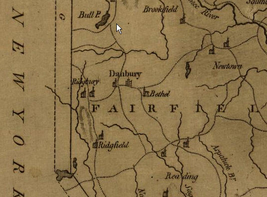 Doolittle's map of 1797
Amos Doolittle, whose 1795 map is shown above, turned out a second Connecticut map two years later. He dropped the town lines, and changed the churches from circles to church-like symbols. And he still called Ball Pond in New Fairfield "Bull Pond."
 Anderson's map of 1799
Alexander Anderson drew this Connecticut map, published in 1799 in New York City. Like Doolittle's map, it shows two churches in Ridgefield (spelled with the first E for the first time in a while) and two in Ridgebury. In fact, the map is very similar to Doolittle's map in not only citing the four churches, but also in its placement of the ranges of hills -- not accurately, either.
 Warren's map of 1812
Moses Warren's map of Connecticut, published in 1812 in
Hartford, is important in several respects. It shows, for
the first time, the new route between Ridgefield and
Danbury through the Sugar Hollow -- the present path of
Route 7. It shows the village's two churches in their
proper places along the west side of Main Street. It also
shows "The Crank" in Ridgebury, the section along George
Washington Highway that was once ceded to Danbury, but was
returned to Ridgefield. It also very clearly shows a
route, heading east from Main Street by the old
Congregational Church on the Green (where Jesse Lee
Methodist Church is now). The road is incredibly straight,
passing through Redding and then veering northeasterly to
the center of Newtown. This is probably Branchville Road,
to Ivy Hill, to Florida Hill, to Old Redding Road in
Ridgefield. In Redding, the path uses several modern-day
roads, including Cross Highway and Church Hill, traverses
Poverty Hollow Road up to Newtown. Clearly, this was a
much more important route 200 years ago than it is today,
when it is mostly winding back roads.
 Finley's
map of 1824
Finley's
map of 1824
Anthony Finley's map, published in 1824 in
Philadelphia, is pretty, with nice colors. But it offers
little else in the way of clues to what was going on --
and what people were doing -- in 1824.
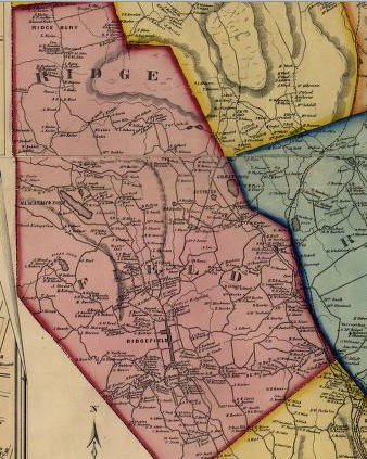 Clark's map of 1856
A cartographer named J. Cache produced the remarkable
Clark's Map of Fairfield County, which attempts to show
the names of virtually everyone owning houses or
industrial buildings in the entire county. The
hand-colored map was designed to hang from the wall. One
can be seen near the exit of the Ridgefield Library, and
another hangs in the taproom of The Elms Inn; neither is
as bright and crisp and colorful as this map in the
collection of the Library of Congress. Clark's map is a
great source of information on who owned what in the
mid-1850s. It also shows almost every town-owned road in
use at the time, an amazing feat of cartography for that
era. Below are segments of the Ridgefield portion of the
map, beginning with Ridgebury at the north and working
southward.
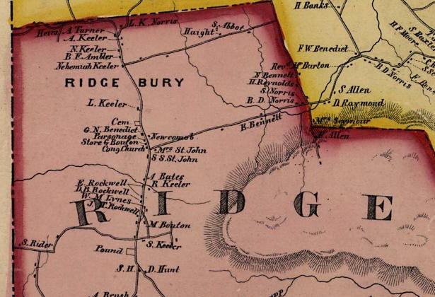
Here is Ridgebury in 1856, according to Clark's map. Note L. Keeler, just above the cemetery. That land is still owned by the Keeler family in 2005.
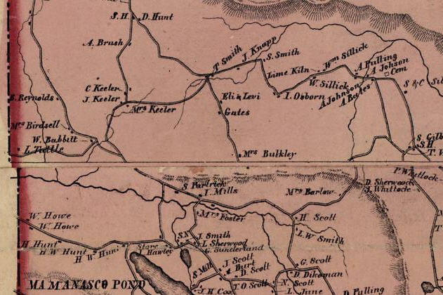
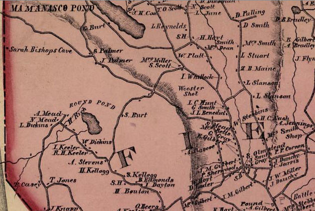
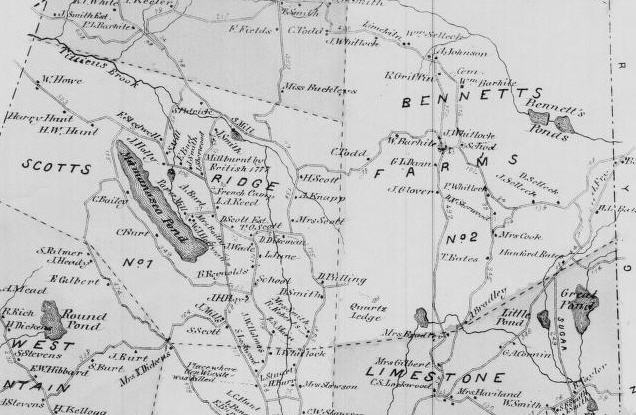
Just below the previous section is southern Ridgebury, including the north end of Lake Mamanasco. At the top is D. Hunt's place, which until recently was McKeon's farm. S.H. means "school house." Notice the several Scott homesteads east of Mamanasco; that's why the neighbor was known as Scotland.
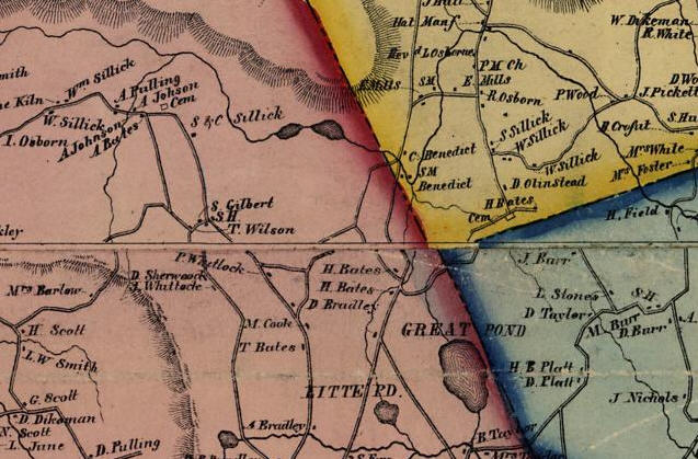
Shifting eastward from the previous map, we see the Limestone region of town, with Little (misspelled) and Great Ponds. That's Danbury in yellow and Redding in aqua. To the north, unlabeled, are the Bennett's Ponds, site of Ridgefield's new state park. The road where H. Bates and D. Bradley have houses is Route 7. T. Bates. is on Great Hill Road. H. Bates is on an old road that ran from Route 7 up to Bennett's Farm Road, from about where Pamby Motors is now. The cemetery ("cem") at top center is the still extant Selleck or Sillick Cemetery on Bennett's Farm Road. Notice that none of today's Ridgefield Lakes are shown; they all date from the 1920s or early 30s. North of Great Pond, opposite H. Bates, is Laurel Lane, now a dead-end road, but which in the 19th Century ran into Redding and then Danbury. A dirt road still exists, and so does the cemetery shown in the southwester corner of Danbury (yellow). This was a route from Ridgefield to Starrs Plain section of Danbury.
Moving back to the west side of town, and down a bit, we have a view of the south end of Mamanasco over to North Street and lower Danbury Road. The West Mountain district, included Round Pond, is also largely show as is the neighborhoods northwest of the village (there's a close-up of the Titicus area below). The little flag at the lower right corner is the site of the Battle of Ridgefield, where Casagmo is now..
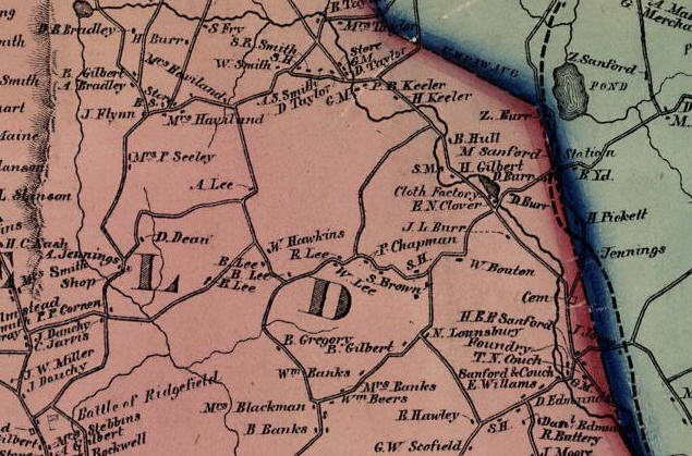
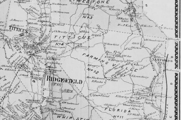
Shifting eastward from the previous map, we see lower Limestone, Farmingville, and upper Branchville sections of town. Note the pond toward the upper right corner, and the "cloth factory" at its southern end. This was the 1850s version of Hugh Cain's fulling mill -- from which Cain's Hill and Fulling Mill Roads get their names. That's Cain's Hill Road where "W. Bouton" lives. Both the Farmingville School House (the S. H. just below the name P. Chapman, and the Florida School House (just east of R. Hawley) are shown, as are at least two grist mills (G.M.) on the Norwalk River. Note the cluster of Lee family homes between the large L and D. This shows the old route of Farmingville Road, now lower Limekiln and Lee Roads. The straightaway across Great Swamp was not built until the early 1900s.
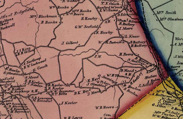
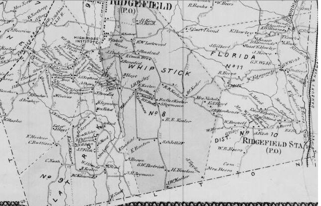
Moving south from the previous map, we see Branchville and, at the left, some of the Nod Hill area (the Branchville corner is shown more closely in a later image). Note the schoolhouse (just below "D. Mead"); this is the Branchville Schoolhouse, still standing in the same location today. At the left, S.H. marks the approximate location of the Whipstick Schoolhouse. The last Whipstick Schoolhouse was incorporated into a house that stood at the north corner of Whipstick and Nod Roads (Nod Road is where J. Keeler, B.T. Betts, W.W. Seymour, etc. lived). That house was once the home of Charles Sheeler, noted American precisionist artist. It was torn down a few years ago to make way for a new and much larger house. The cemetery at the bottom of the image, on Nod Hill Road, is the old Beers Cemetery.
Shifting westward from the previous map, this image shows the center of town, lower West Mountain district, upper West Lane District, and upper Flat Rock District. The village, with black lines along Main and Catoonah Streets denoting a more "urban" state of development, is shown on a separate inset in the Clark map and appears below in four segments.
Here is the very bottom corner of town on Clark's map, showing such highways as lower Silver Spring Road, lower Wilton Roads East and West and lower Nod Road. The town of Wilton is shown in yellow. This, by the way, is the territory where Jared Nash, the farmer whose annotated diary appears elsewhere on this site, lived in the mid-1860s; his house on Silver Spring Road opposite the lower end of St. John's Road, is shown as C. Nash; Charles Nash was his father.
Here is close-up of the Branchville corner on Clark's map. Notice how the main north-south highway is on the east side of the tracks. It was not until the 1920s that the main highway, today's Route 7, was moved to the west side, thus avoided two crossings of the tracks for the increasingly numerous automobiles
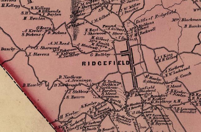
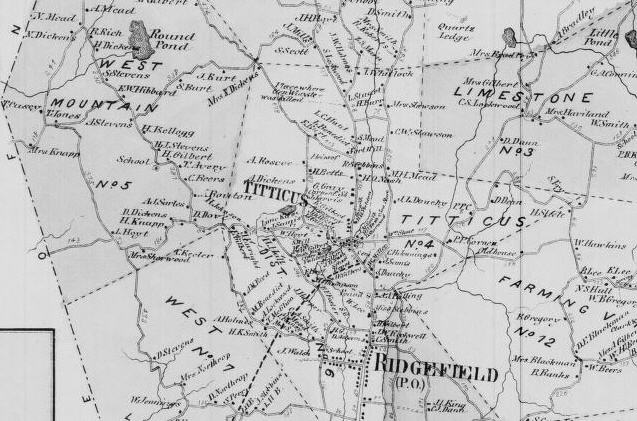
Here is a close-up of Clark's map, showing the northern village, Titicus and the Copps Hill area. J. Dauchy lived on the corner of Danbury and Copps Hill Roads, where the shopping center is now. Although it was certainly in existence, the cemetery in the triangle of North Salem, North and Mapleshade Roads is not denoted on the map; in fact, it shows a J.W. Miller house where today, there are only graves. The schoolhouse (S.H.) is the Titicus School, now the headquarters of the American Legion, at the corner of North Salem Road and New Street (which was not built until 50 years after this map was drawn in 1856).
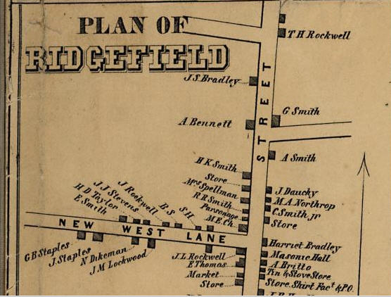
Clark's map includes an inset showing the village of Ridgefield in 1856. Here's the northern segment. Where Harriet Bradley's house was became the site of the town hall in the 1870s. Masonic Hall still stands just to the south, though the original was burned in the fire of 1895. Bailey Avenue, just north of Harriet Bradley's place, had not yet been built; it was mainly a route to the railroad warehouses that would come after the rail line was built to the village in 1870. Catoonah Street is here called New West Lane, a name that did not last long. When a large building called Catoonah Hall was erected on the south side of the lane, about opposite today's firehouse, the road picked up its name and was called Catoonah Street. The mapmaker may have mistakenly used "New West Lane" for this road when it should have been used for Barry Avenue, farther to the west, which was built in the 1800s as a new road west to West Mountain. Catoonah Street existed in the early 1700s and is hardly "new" in relation to West Lane, to the south.
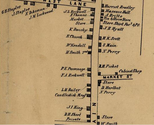
Shifting south, here is the next segment of Clark's inset of Ridgefield village. Note the village's "store, shirt fact[ory] & p[ost] o[ffice]," a seemingly odd combination of activities in one building. Shirt-making was largely a home industry, with most of the sewing done by women in homes. The final touches and packaging were done at the "factory," which was probably little more than a good sized room. The fact that Market Street was so-called as early as 1856 is interesting; it reflects the existence of David Hurlbutt's market near the corner. Note that the "E. Church" -- St. Stephen's Episcopal Church -- was located a bit north of the "P E. Parsonage" (P.E. being Protestant Episcopal). The old parsonage is now a private residence. For many years, it was painted pink, and called "The Pink House." The "store" on the east side of Main Street at the bottom of the image was The Old Hundred, a general store operated by Lt. Joshua King and a man named Dole in the post-Revolutionary era that remained a store through most of the 19th Century. It is now the second floor of the Aldrich Contemporary Art Museum (a new story was built underneath the old store in the 1960s).
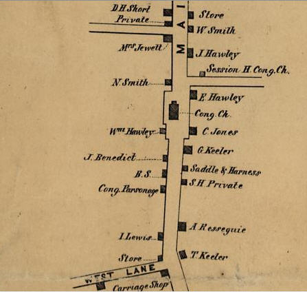
Here is the next segment of Clark's Ridgefield village inset. Prominently shown, though not labeled as such, is the old Village Green surrounding the Congregational Church ("Cong.Ch."). In 1888, the current First Congregational Church opened at the corner of West Lane (where the map says "carriage shop") and the old church on the green was moved elsewhere or razed. The site is now part of the front lawn of Jesse Lee Memorial United Methodist Church. Notice how Branchville Road, south of J. Hawley, has no name; it was probably just a little farm lane back then. When the station in Branchville opened in 1852, efforts began to improve the road eastward from the village to the southeast corner of town. And when road improvements were completed, this little lane took on greater importance.
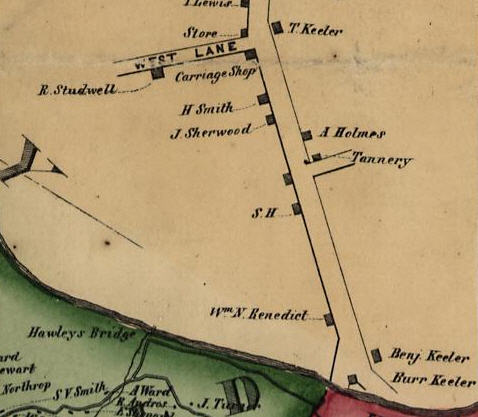
And here is the southernmost segment of the village inset. Noteworthy here is the "carriage shop," better known today as the Big Shop. When the Congregational Church bought the property to build its new stone edifice, the Big Shop was moved to the center of town, and now sits north of the Bailey Avenue parking lot, where it houses two restaurants, La Saliere and Luc's Cafe, and several shops and offices. In the 1860s, Hannibal Hamlin, vice president under Abraham Lincoln, spoke in the hall of the second floor of this building. Across from West Lane is the property of T. Keeler. That was Timothy Keeler, proprietor of the Keeler Tavern. To the south, on the north corner of Rockwell Road, stood an old tannery; hard to imagine a "factory" on Main Street in the prime of its historic district, but that was the case. A little more to the south is the Bell District schoolhouse (S.H.), said to have been the only schoolhouse of more than a dozen in town that had its own bell. After the schoolhouse burned down in 1865, it was not replaced. The William N. Benedict house near the south end of Main Street still stands.
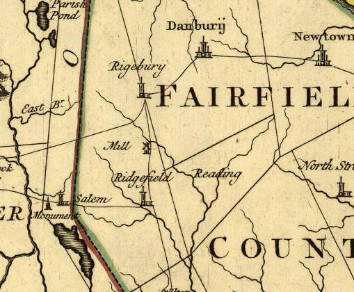
 Beers' map of 1867
Beers Atlas of Fairfield County, one of many atlases
produced by this company in the 1860s and 1870s, offered
detailed maps of each town. Every house and business
building was identified with a name. Each school district
was spelled out, and hand-painted in its own color. All
public roads and railroads were shown, as were many points
of interest. Below are a series of close-ups of the
map, including the insets for Titicus and Ridgefield
Station (now called Branchville). To examine these maps in
more detail, visit the University of Connecticut's online
historic map archive linked at the end of this page.
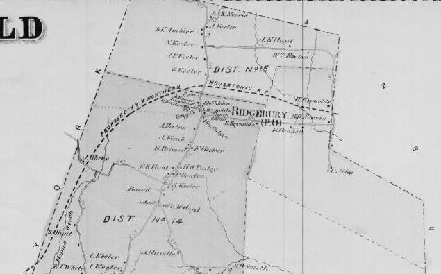
Beers view of Ridgebury,
1867
The northernmost part of Ridgefield looked like this
in 1867. Ridgebury had its own post office, schools,
church, cemetery, and at least one store back then. The
proposed New York and Northern Rail Road was never
completed, though the bed for the track was built and can
still be seen today. The Housatonic Rail Road Tracks were
laid from Danbury to Ridgebury center, and for a while, a
trolley ran over them.
Beers view of Scotts
Ridge and Bennett's Farm, 1867
Just below Ridgebury are the Scotts Ridge, or
Scotland, and Bennett's Farm(s) School
Districts. Only the Bennett's Ponds existed in
Bennett's Farms district back then; the Ridgefield Lakes
are all man-made creations of the 20th Century.
Beers view of Limestone,
West Mountain, Titicus, & the upper village,
1867
Here is the center of the Beers map, showing several
school districts. Also shown is yet another proposed
railroad, for which a bed and little else was built. It
was supposed to go from Titicus to Port Chester, and New
York City.
Beers view of
Farmingville, Florida and upper Whipstick Districts,
1867
Here is an east-central view of the town on Beers'
map. The Danbury and Norwalk Railroad is show at the
extreme right; it did not end where shown -- the mapmaker
chose to end his depiction of it there, assuming the atlas
owner would pick up the continuation by viewing the
Redding map page. The houses in the village were too
numerous to label, but were included in a special inset on
another page, not yet available here, that included
owners' names.
Beers view of Ridgefield
Station, Whipstick, Flat Rock, and West Lane, 1867
This segment, showing the bottom of the map,
includes Ridgefield Station (now called Branchville),
Whipstick, Flat Rock and much of the West Lane school
districts. The "village" of Ridgefield Station
is shown below.
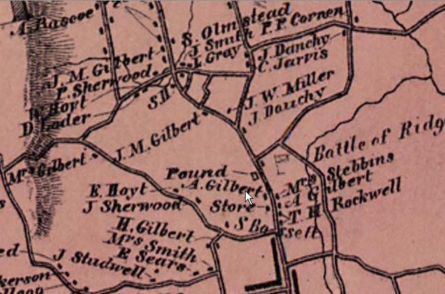
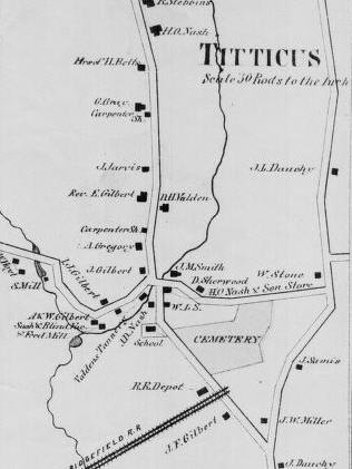 Titicus inset on Beers, 1867
This inset shows the village of Titicus, just north of
Ridgefield village. That's North Salem Road (Route 116)
running north to south in the center of the map. Saw Mill
Hill Road goes off to the left, and Mapleshade Road to the
right, while North Street runs north-south at the extreme
right side. Note all the mills along Saw Mill Hill Road --
it was an industrial center back then, with saw, feed,
grist and cider mills, and D. Harvey Valden's Tannery.
Many of the mills were owned by the Gilbert family.
Titicus had its own school, post office, and store (the
store and post office were at the intersection of North
Salem and Mapleshade Roads), even though it was a
relatively short distance from the center of Ridgefield
village. As noted above, the railroad was never built,
though a track bed was. Probably the building of the
branch line from Branchville into the village in 1870 made
the new and much longer road impractical.
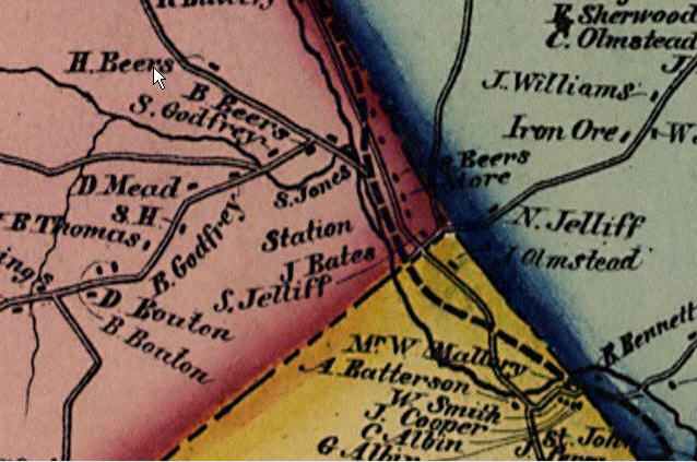
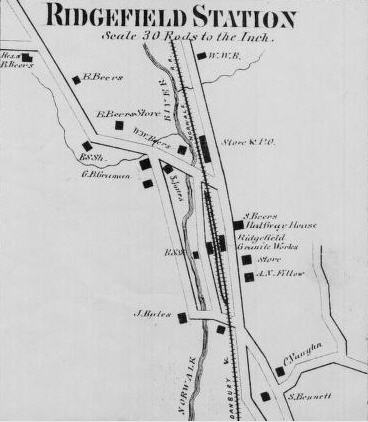 Ridgefield Station inset on Beers, 1867
The Ridgefield Station inset in Beers map shows how the
main, north-south highway used to be on the east side of
the railroad tracks. In the 1920s, it was moved to the
west side to become part of Route 7. The old highway on
the east side still exists as the stupidly named "West
Branchville Road," and many of the buildings shown here on
that road are still standing. This map was made before the
branch line to Ridgefield center was built in 1870,
leading to the new name of Branchville for this section of
town.
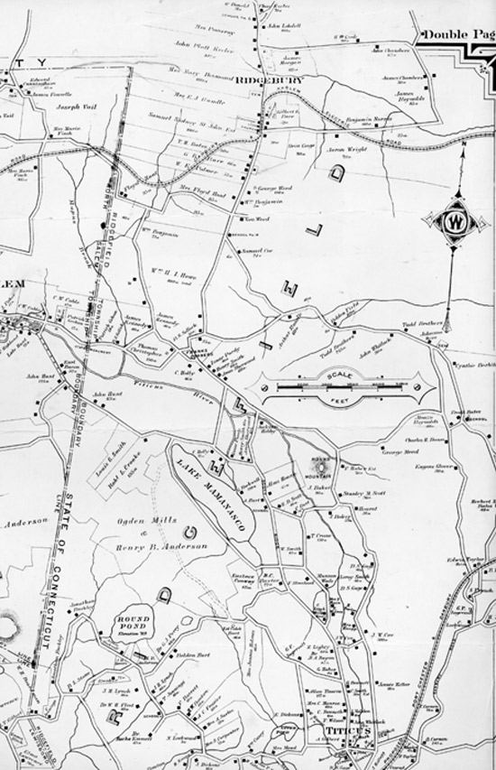
Northern Ridgefield, ca.
1900
This is a page from an atlas published early in the
20th Century, and shows the northern half of town (with a
bit of the east side chopped off). It is interesting in
that it shows the paths of two proposed railroads that
were never completed. At the lower right is the proposed
Port Jefferson and Danbury Railroad. The land for this
railroad was acquired by the company (and was later owned
by the New Haven Railroad). Some of the bed was built, but
tracks were never laid. Up in Ridgebury is the route of
the "Danbury and Harlem Electric Road." In its case,
tracks were laid from Danbury as far as the center of
Ridgebury, and a trolley actually provided service for a
year or so. Beyond Ridgebury and well into New York State,
track bed was built (and can still be followed today), but
rails were never laid. (A section of this map, showing the
south part of town, will be added later -- as soon as I
figure out what I did with it.)
Many of these maps were found in the University of Connecticut's Historical Map Collection. The collection is online, and includes a viewer that enables the user to zoom in and out of maps, and to move around them. Visit http://magic.lib.uconn.edu/